Infrapedia will radically amplify the ability of network professionals around the world to identify potential network infrastructure problems.
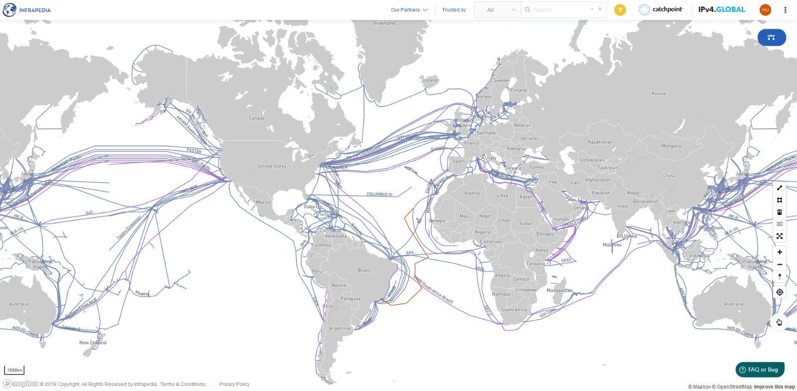
Infrapedia is a map of the globe that shows submarine and terrestrial networks, providing operational visibility to professionals who will be able to use it to easily track and receive notifications on network outages, identify places where expansion is possible, and quickly procure additional capacity.
Users who visit Infrapedia are shown a map of the globe with green lines representing active networks and yellow and red lines representing networks with issues. A quick hover of a cursor over any single network reveals its name, total capacity, most recent status, and other important details.
“Atlases have been valuable tools for explorers and business owners for hundreds of years,” says Infrapedia Founder Mehmet Akcin. “Now, we’re in the digital age, and our digital explorers need an atlas so they can navigate the world’s fiber-optic Internet Infrastructure. We are adding networks daily and look forward to the day where we can say we have a complete accounting of the world’s submarine and terrestrial networks. These are networks for international and regional telecommunications networks for companies like AT&T , Zayo and Windstream, as well as for cloud providers. Being able to see the near real-time status of these networks all in one place will be an invaluable tool for the world’s network professionals.”
Infrapedia is a crowd-sourced network with data from companies and professionals to help complete the data. The project is a nonprofit funded by sponsorships and other means of donations to make sure it stays free for users. For more information aboutInfrapedia, contact us.